Weir Family
Weir Family
Texas Historical Marker: no
- Primary Town: Weir
- Secondary Town(s): Georgetown
- Cemetery Relocated to: no relocation
Historic Texas Cemetery Designation: no
- Williamson County Clerk Instrument Number: 19627153DR; 19627154DR; 19711072DR
- Williamson Central Appraisal District Property ID: R039114

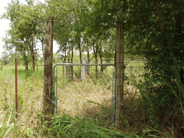
Weir Family Photo Courtesy John Christeson 2010

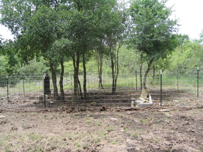
Weir Family Photo Courtesy Texas Historical Commission Atlas
Notes:
WCHC’s Vol II, pg 352: Per Van Tipton 1975…”located about 1.5 miles E [probably typo should be: W] of Weir on the N side of FM 971 in a pasture at the junction of FM 971 & a narrow black top road curving off to the N.” “From Georgetown take Business Highway 81 (Austin Avenue) N for almost a mile, N of the North San Gabriel River Bridge, & turn right on FM 971, marked Weir & Granger for about 6 miles to a point about 150 yards E of the Berry’s Creek bridge. There appears to have been somewhere between 15 & 20 graves here but most have been mutilated, or made of soft limestone markers (T.C. Weir).”
From Weir W on FM 971; E of Berry Creek Bridge; N 40 degrees from bridge approach.
Find-A-Grave: “From Georgetown take Austin Avenue to the junction with FM-971. Turn east or left on FM-971 and continue on this road crossing the Berry Creek Bridge when you will see the Weir City Limits sign on your right or south and the junction with CR-194 on your left or north side of the road. Park on the shoulder of CR-194 and walk west in the ditch a short distance along FM-971 until you see a gate in the fence on the north side of the ditch. The cemetery is on the other side of the gate. The cemetery consists of three fenced in enclosures in a pasture. The largest enclosure had one square, tall gravestone with four names on it, a mother and her three children. There is also the ruins of crypt with no observable name on it. The other two enclosures contain one gravestone each.”
In 2018, this cemetery is maintained by the “Cemetery Restoration Volunteers” as one of the abandoned cemeteries maintained on a rotation basis of 19 cemeteries in Williamson County. The volunteers are under the direction of WCHC’s Cemetery Committee Chair, Joe Plunkett. In 2019, there are 9 volunteers, using their own equipment. Donations received by WCHC help to defray costs of restoring tombstones.
Location is Approximate (1999 Map Information): yes (1999 mapped F3) OK 9/27
Latitude: 30.67669
Longitude: -97.6123
332