Everts - Garner
aka Garner/Everts
Everts – Garner
Texas Historical Marker: no
- Primary Town: Hare
- Secondary Town(s): none
- Cemetery Relocated to: no relocation
Historic Texas Cemetery Designation: no
- Williamson County Clerk Instrument Number: unknown
- Williamson Central Appraisal District Property ID: R005574

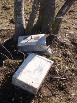
Everts-Garner Photo Courtesy John Christeson January 2011

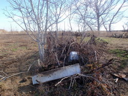
Everts-Garner Photo Courtesy John Christeson January 2011

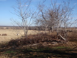
Everts-Garner Photo Courtesy John Christeson January 2011
Notes:
WCAD R005574 at 10951 FM 1331, Taylor – only property found with prior owner name “Benhard Pasemann”
WCHC’s 1999 Volume III, pg 79: Per Clara Scarbrough & Bennie Paseman: “This small cemetery near Hare has lost at least two of its markers, names unknown, possibly others. It is on the placed owned in 1984 by Bennie Paseman just E of Hare. From Hare, go on FR 1331 for .3 mile to the Paseman home. The small cemetery is in a pasture N of this house, near a stock tank, & at two large hackberry trees. One of the graves is fenced; the other grave markers has fallen over, but is intact…”
E CR 429, N FM 1331, S of Pecan Creek
Per John Christeson on Find-A-Grave, “This small cemetery, consisting of two gravestone, has lost at least two of its markers, names unknown, possibly others. It is on the farm owned in 2011 by Bob Nicholaon at 10951 FM 1331, just 0.3 miles east of Hare on FM 1331. The cemetery is in a pasture north of this house, near a stock tank and two large hackberry trees.
The Garner grave is enclosed by an iron fence that has mostly fallen over and been trampled by cows pastured here. The gravestone has fallen off its base and is on the ground with the inscription visible. The Everts grave marker is about 15 feet to the side of the Garner grave. It also has fallen over, is intact and its inscription visible.
To visit this cemetery call Mr. Nicholson at 512 431 6665. He does not live on the farm. There is a tenant who is not authorized to permit entry through the locked gate to the cemetery.”
Location is Approximate (1999 Map Information): yes (1999 mapped J3) OK 9/7
Latitude: 30.67282
Longitude: -97.26655
348