Chalk Ridge
Chalk Ridge
Texas Historical Marker: no
- Primary Town: Florence
- Secondary Town(s): none
- Cemetery Relocated to: no relocation
Historic Texas Cemetery Designation: no
- Williamson County Clerk Instrument Number: 1993023342, 1996005280 & 2007032515
- Williamson Central Appraisal District Property ID: R009919, R009800, & R549495
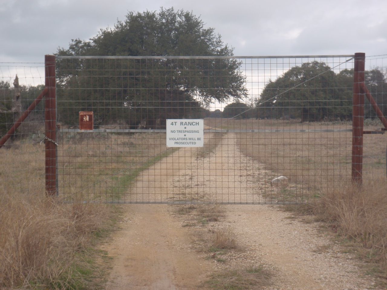
Gate Entrance to Preserve and Cobb Cavern approximately 493 ft W of Highway 195 & CR 239 intersection, Florence Photo Courtesy John Christeson February 2019
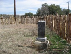
Chalk Ridge Photo Courtesy property owner through John Christeson 2011
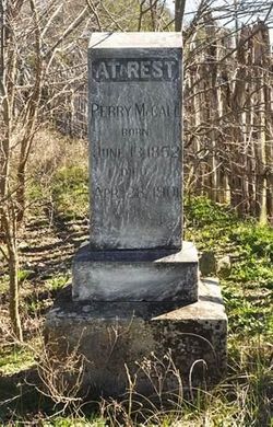
Chalk Ridge Photo Courtesy property owner through John Christeson 2011
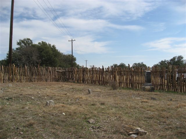
Chalk Ridge Photo Courtesy property owner through John Christeson 2011
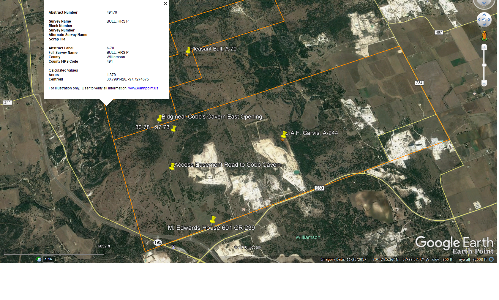
Google Earth map shows Bull, P & Gravis, J.A.F. surveys centroid, Mr. Edwards home, Cobb Cavern building at eastern cave opening 2019
Notes:
Chalk Ridge is on WCHC’s 1986 & 1999 map; however, the cemetery is shown on the wrong side of CR 239. Chalk Ridge Cemetery’s description was entered in the Vol III, pg 77 WCHC notebook under “Cobb Springs Cemetery”…”In pasture about mile from house, one marker. Field stones mark twelve other graves nearby, unidentified: Perry McCall 1852 – 1901. Submitted by Mrs. Marvin B. Edwards, 1984″
Ronald Reagan Rd (FM 734) & CR 239 area, N Hwy 195 (very close to where Ronald Reagan Road was constructed in 2010’s).
Per John Christeson in Find-A-Grave…”this cemetery is one of the former lost cemeteries in Williamson County, TX. It is located at 101 CR 239, Florence, TX on the 4T Ranch [2010 = changed name to CCR Holdings 1 LLC & Lyda Holdings LLC] owned by the Lyda Family Trust, PO Box 1757, Georgetown, TX. The Trust also owns & operates the Monument Cafe on Austin Ave in Georgetown. The 4T Ranch is operated as a Wildlife Management Preserve. There was about 11 or 12 graves there. The only one that had a headstone, still readable, was that of Oliver Hazard Perry McCall. Peggy McKenzie of the Trust, stated they did not know of the cemetery when the property was purchased in September 2010, & it was only discovered by accident when some brush was being cleared. A worker taking a break discovered the cemetery.”
After further research in 2019, there are 2 cemeteries (Chalk Ridge & Cobb) located on the Wildlife Management Preserve which encompasses the Cobb Cavern 64.4 acre Conservation Easement purchased by the Williamson County Conservation Foundation in 2007; a portion of the springshed for Cobb Springs, home to the Georgetown salamander; and a building used by people to gather before entering the eastern side of the cave on a limited basis as a show cave from 1962 through the early 1970’s.
The address for the house of Marvin B. Edwards is 601 CR 239, Florence.
The gate shown in the picture above is approximately 493 feet W of Highway 195 & CR 239 intersection–John Christeson noting coordinates as 30.75916, -97.72604 at the gate entrance.
The coordinates for the cemetery came from using Google Earth – locating the fence surrounding the cemetery.
The Whitmire Manuscript at rootsweb.com/~gowenrf collaborates the ranch was owned by Marvin B. Edwards, the existence of Chalk Ridge Cemetery and Oliver Hazard Perry McCall died April 28, 1901 and was buried in Chalk Ridge Cemetery located on Cobb Ranch- his tombstone was the only one remaining in the cemetery of some 11 or 12 graves in 1970, according to Mary Alnora “Nora” Cox Drennan who reported that it had fallen face down (manuscript link below).
Location is Approximate (1999 Map Information): (1999 mapped E2) Verified 2019
Latitude: 30.763156
Longitude: -97.725925
423