Bertram Family
Two Graves on the Bertram Place
Bertram Family
Texas Historical Marker: no
- Primary Town: Bertram
- Secondary Town(s): Florence
- Cemetery Relocated to: no relocation
Historic Texas Cemetery Designation: no
- Williamson County Clerk Instrument Number: 192102564DR & 19741766DR
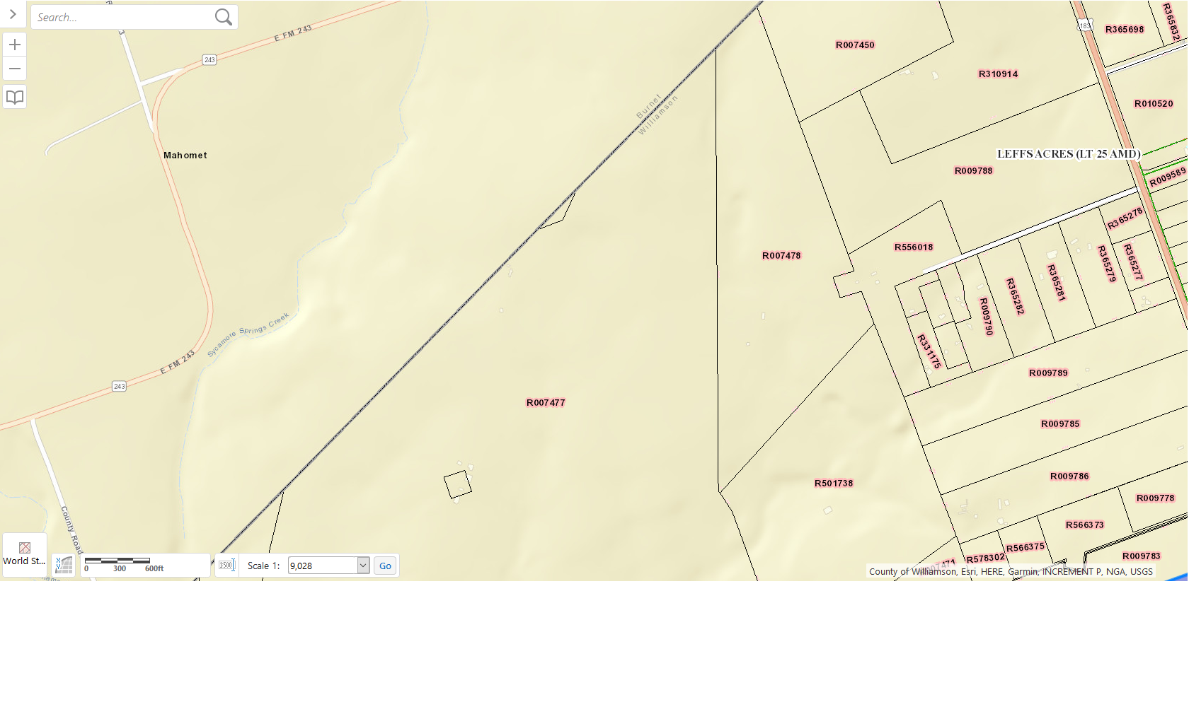
- Williamson Central Appraisal District Property ID: R007476 & R007477

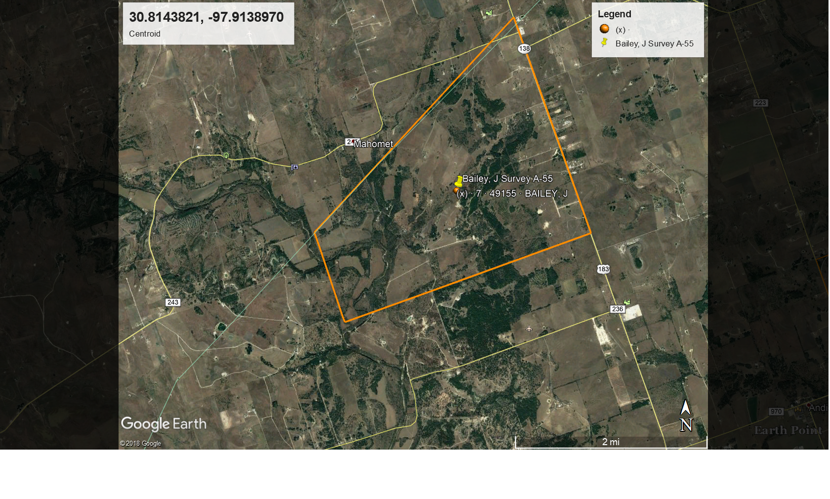
Bertram Family J Bailey Survey A-55 FM 243 & Highway 183
Notes:
2016 WCAD, based on hand drawn map in WCHC Notebook, access to cemetery use 12333 FM 243, Bertram

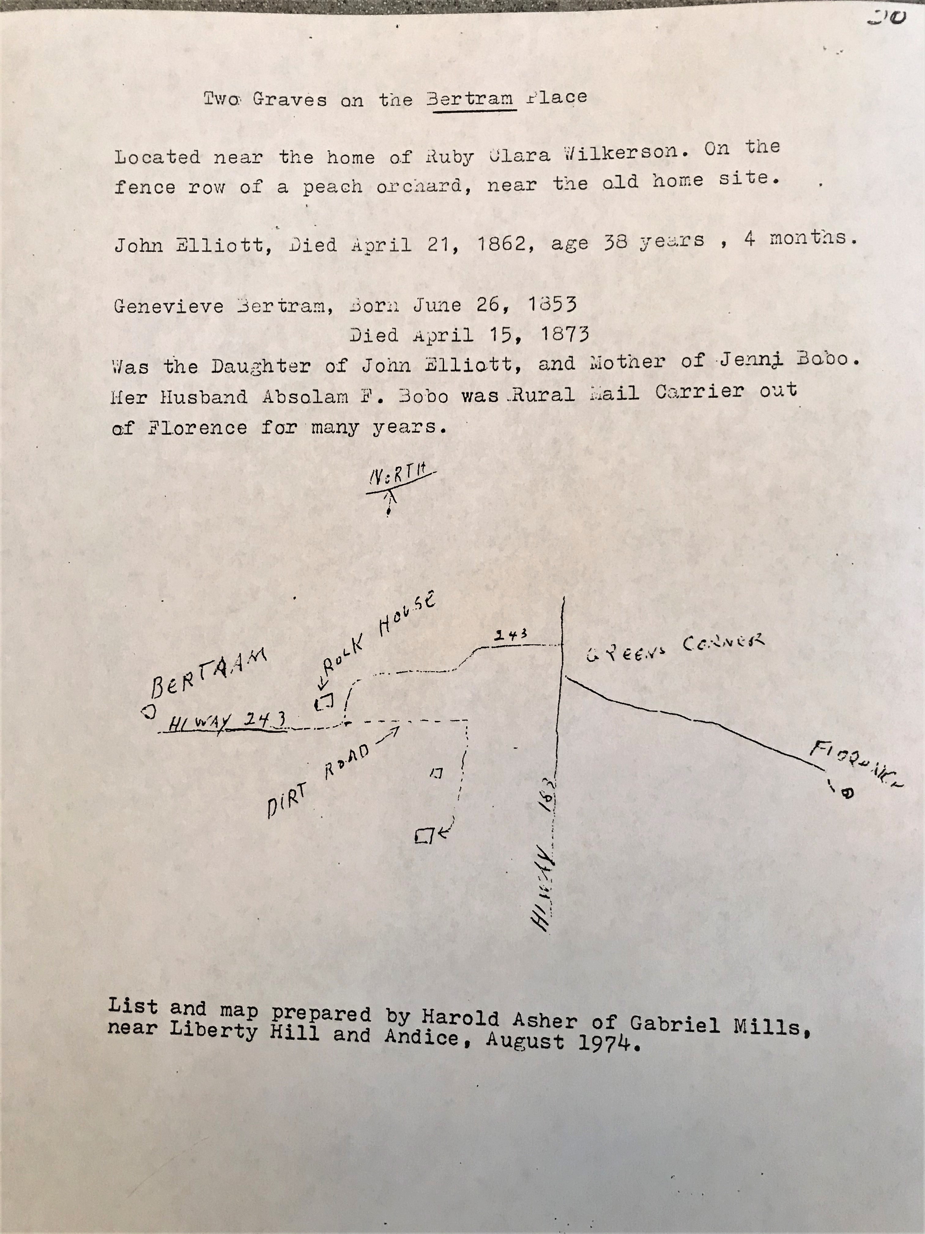
Bertram Family hand drawn map from WCHC Notebook Vol 1 Page 30

Bertram Family WCAD map shows property inside Williamson County
WCHC’s Vol I, pg 30, [page includes a hand drawn map to cemetery-see picture above] list and map prepared by Harold Asher of Gabriel Mills, near Liberty Hill and Andice, August 1974…”Two Graves on the Bertram Place…located near the home of Ruby Clara Wilkerson. On the fence row of a peach orchard, near the old home site.
John Elliott, Died April 21, 1862, age 38 years, 4 months.
Genevieve Bertram, Born June 26, 1853, Died April 15, 1873
Was the Daughter of John Elliott, and Mother of Jenni Bobo.
Her Husband Absolam F. Bobo was Rural Mail Carrier out of Florence for many years.”
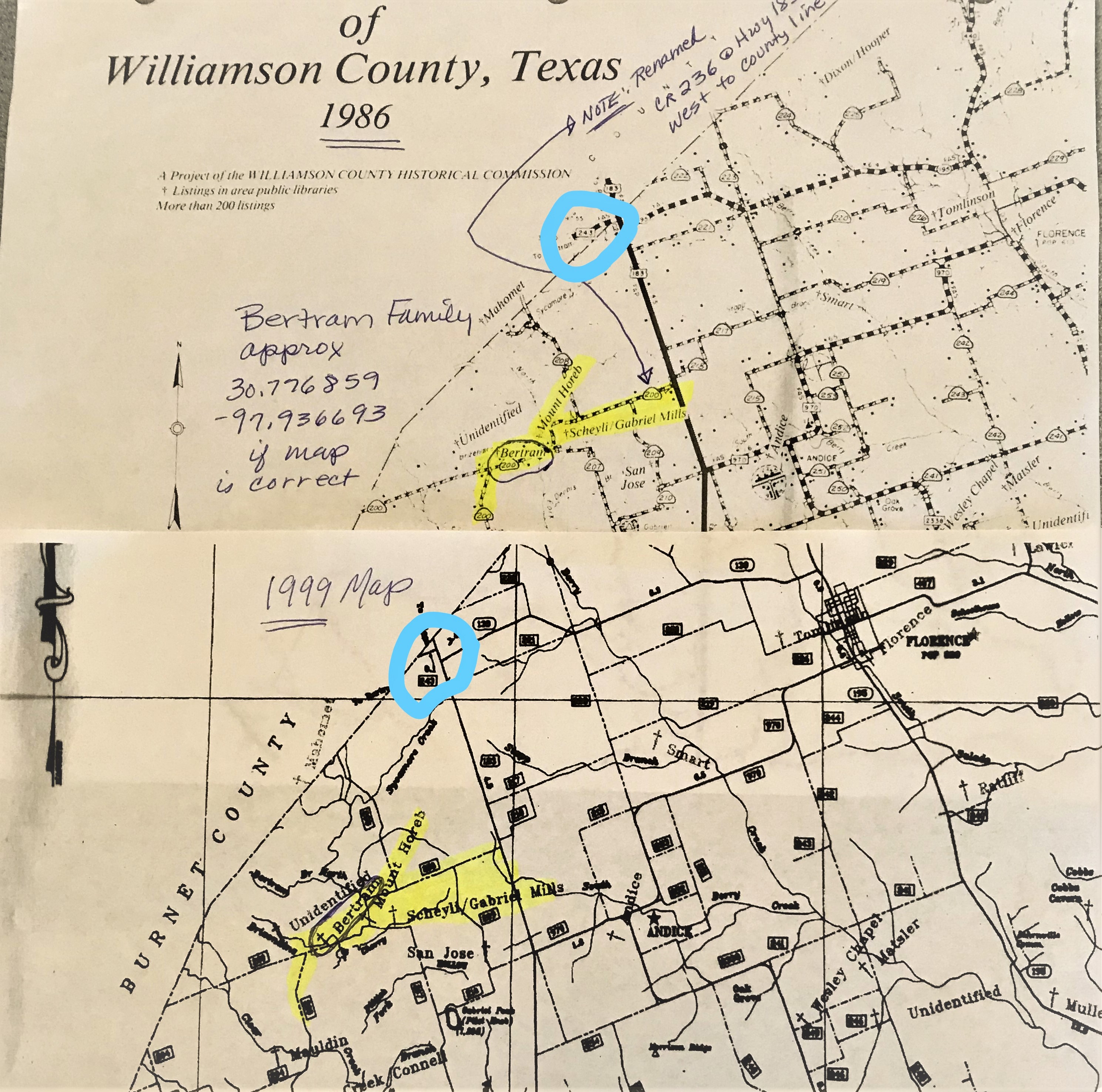
DISCREPANCY: WCHC’s 1986 & 1999 Map, “Bertram” Cemetery is marked at: N side of 3360-3620 block on CR 236 near CR 200, on bank of Brizendine Creek (see picture below). The marked location on the maps will be considered inaccurate, until proven otherwise.

Bertram Family WCHC 1986 & 1999 map showing probable inaccurate location of cemetery
Coordinates are centroid of John Bailey Survey Abstract A-55 from Google Earth.
Location is Approximate (1999 Map Information): (1999 mapped B2) inaccurate location until proven otherwise 2019
Latitude: 30.8143821
Longitude: -97.913897
380