Barker Family
Barker Family
Texas Historical Marker: no
- Primary Town: Coupland
- Secondary Town(s): none
- Cemetery Relocated to: no relocation
Historic Texas Cemetery Designation: no
- Williamson County Clerk Instrument Number: unknown
- Williamson Central Appraisal District Property ID: R008539

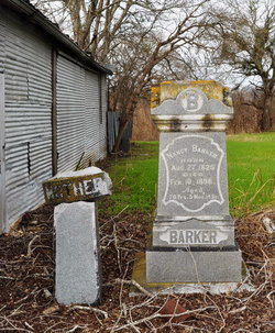
Barker Family Photo Courtesy John Christeson 2017

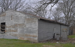
Barker Family Photo Courtesy John Christeson 2017

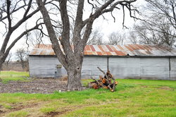
Barker Family Photo Courtesy John Christeson 2017
Notes:
2019 WCAD: 17454 FM 1660, Coupland
WCHC’s Vol I, pg 24 per Ruth Mantor, Mahon Garry & Joe Hannah Forson 1975 ”This small family cemetery is located S of Taylor, one & one-quarter mile W of Hwy 95 off FM 1660, on the Ted. Wittliff farm.”
S of FM 1660, E CR 405, N of bank on Brushy Creek
2019 Find-A-Grave: “This family cemetery is located off of Highway 1660 between Rices Crossing and Highway 95. From Rices Crossing continue east on 1660 until you see the Highway 406 sign on your left. Turn in at the next driveway on your right (mailbox 17454) and continue on the driveway passing two houses on your right until the driveway dead ends at a shed with a gravestone in front of it. There is only one gravestone, but evidence of at least two or more burials. The cemetery is on land owned by Ted Wittliff who lives in the second house.”
Location is Approximate (1999 Map Information): yes (1999 mapped H6) OK 9/27
Latitude: 30.469536
Longitude: -97.425026
430